Gulf of Policastro - Maratea
Gulf of Policastro: A Coastal Paradise
The Gulf of Policastro is conventionally considered to extend from Punta Iscoletti (in the municipality of Camerota, Salerno) to Capo Bonifati (in the municipality of Bonifati, Cosenza). It is framed by mountains, notably Monte Bulgheria [see photo], Monte Coccovello and Monte San Biagio, which plunge steeply towards the sea.
At the moment, the entire area contains only the Marine Protected Area of the Costa degli Infreschi and the Masseta, while the Marine Protected Area of the Maratea Coast is still in the definition phase.
After Sapri, and for the entire section that includes Maratea, the coast is high and rocky, as it is before Scario; the central part corresponding to the areas of Policastro, Vibonati, and Villammare is instead low and sandy.
The following are reference points for the navigator, from North to South.
GULF OF POLICASTRO
GULF OF POLICASTRO
The Gulf of Policastro /1 : from Cape Iscoletti to Acquafredda di Maratea
It begins with a quadrangular tower raised halfway up the hill (Iscoletti Tower or Lighthouse), followed by another tower attached to a two-story white building at Scario, on which is situated lantern number 2672.
Beyond the aforementioned sandy line, one reaches Cape White, which marks a square-shaped bay with rocky shores, within which is located the territory of the municipality of Sapri.
A red, quadrangular crenellated tower, 4.5 m high, supports lantern number 2676 and is located at the northwest end of the cove.
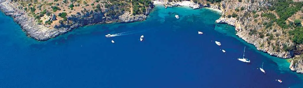
The Gulf of Policastro /2: from Acquafredda to Castrocucco (Maratea Coast)
see
The Gulf of Policastro: from Castrocucco to Cape Bonifati:
Reaching the Calabrian territory, the island of Dino detaches from land, with a short stretch of navigable water only in part, as a long tongue of sand extends from the land.
The island is almost entirely covered with vegetation except in the southeast, where some dome-shaped structures can be seen. The cliffs are steep all the way to sea level, with some cavities that are accessible by boat.
Capo Scalea is a plateau-like headland with steep coastal cliffs rising to around 100 metres, dropping sharply towards the town of Scalea.
Just offshore from the town lies a particularly hazardous shoal, with rocks at the water’s surface that are difficult to spot in calm conditions.
The coast as far as Cape Bonifati does not offer particular shelters; the Island of Cirella, to the SSW of Cirella, can provide temporary refuge, as there is a depth of 11 meters in the middle of the channel between the land and the island.
Head Tiree is surrounded by rocks and shoals up to about 300 meters offshore.
Submerged deposits
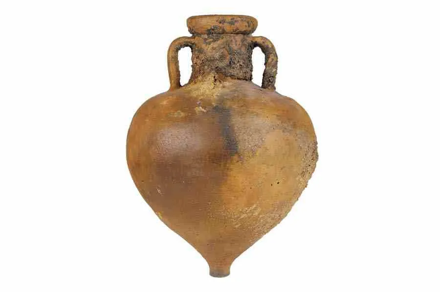
Important deposits of anchor stones and Roman-era amphorae have been discovered on the seabed of the Gulf of Policastro, testifying to the traffic that existed in these waters in ancient times.
To understand more we suggest visiting the museums located in the area, first of all the one in Maratea where various examples of cippi and amphorae are collected, as well as other archaeological finds.
Italy's last travel frontier
A NEW WAY TO EXPLORE THE CITY
AN ENTRING TREASURE HUNT
that unites the entire family in fun
MARATELL. THE LEGACY OF THE SARACEN
A StreetAdventures™ necklace adventure