
The villages of Maratea
How many Maratea ? - the Map
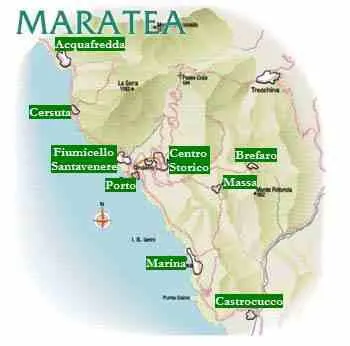
Maratea is made up of several hamlets around its historic centre, once known as Il Borgo. The centre lies on the south side of the valley, 310 metres above sea level, on the slopes of Monte San Biagio.
The municipality borders the Tyrrhenian Sea and the municipalities of Sapri (Salerno, Campania), Tortora (Cosenza, Calabria), Rivello and Trecchina (Potenza, Basilicata).
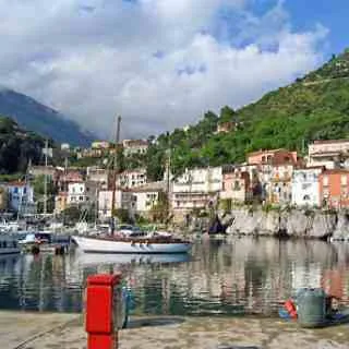
From north to south, the coastal hamlets are Acquafredda, Cersuta, Fiumicello–Santavenere, Porto, Marina di Maratea and Castrocucco.
Inland, east of Monte San Biagio, are Massa, Brèfaro and Santa Caterina (Castello). Curzo and Campo lie to the west.
The character of these different places is part of Maratea’s appeal.
The website www.maratea.info is updated by the volunteers of ALTRITURISMI.it
MAKE A DONATION
- To stay updated on the activities of AltriTurismi ETS -> Subscribe to the newsletter